The first question that puzzled me while considering what to create for this self-portrait map was that of timeliness and timelessness- at what point does a map, or data, or the truth fail to represent the moment? In order to address this question I decided to approach my map by first creating boundaries for my construction, in this case, the temporal kind. My map is a map of an hour, and hour inside my thoughts, it is a portrait of myself in its most truthful state because of being time-bound, it is not to say that I am not the person in my portrait now, but that more accurately it represents an hour of self-truth that has passed. My map will make visible that which is internal in regards to my thoughts and emotions, juxtaposed with literal external reminders of the world’s influences. It is a map of affect.
The hour that my map represents is based upon a random hour, taking voice-memos along the way to remind me of things I have thought of. I also set 6 alarms on my phone at random intervals at which I stopped to take a picture of the location I was in. I will use Google Maps later to determine the distance of my route travelled.
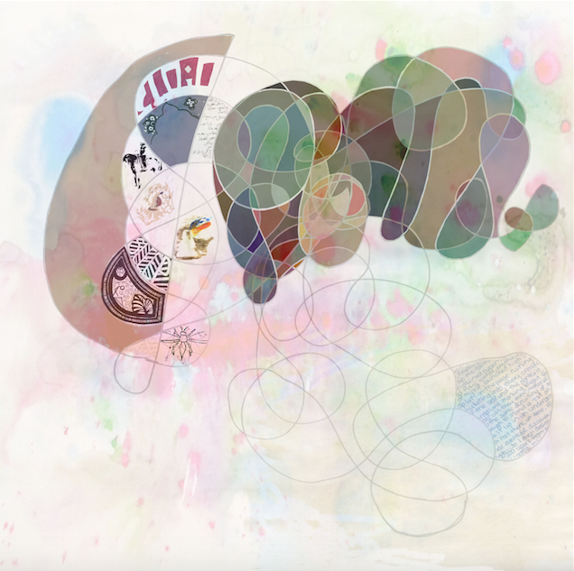
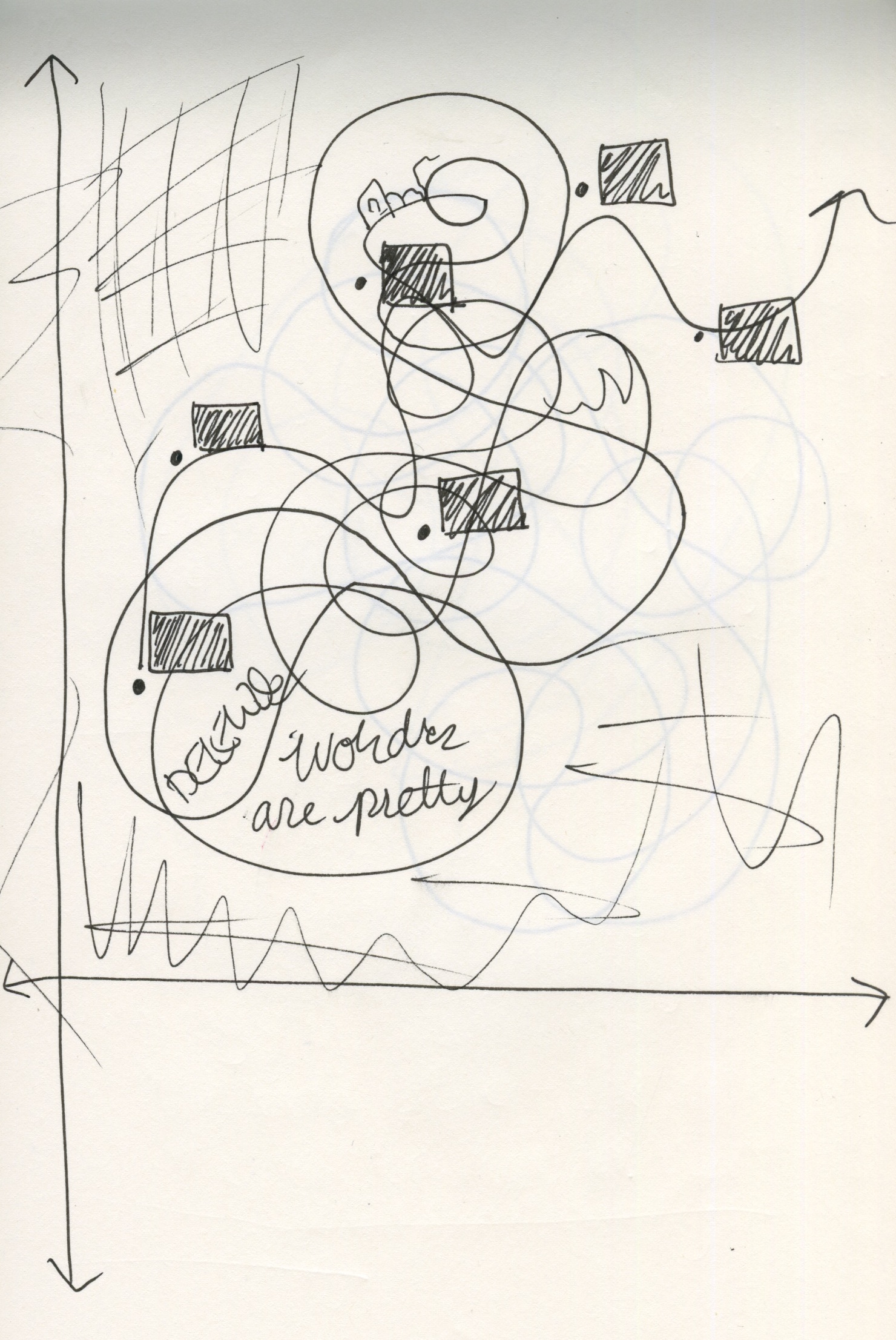
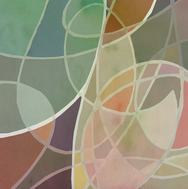
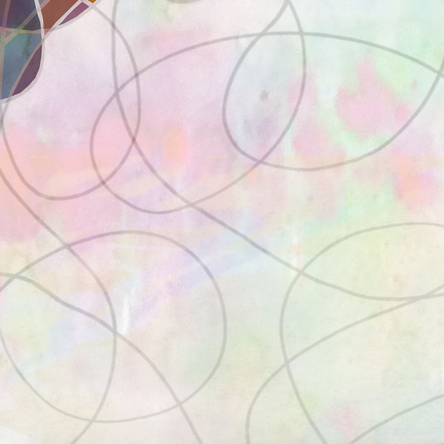
For creating my map, I conceived of it in 4 layers. The first being a mixed overlay of doodles that I often draw when my mind wanders (taken from random notebooks). The second layer is filling for the doodles, each shape taking on its own identity through color, words or pictures/drawings. The colors are loosely representative of my emotional mood turbulence, while the words pictures and drawings attempt to relay had thoughts and memories (not necessarily all of them make sense to an outsider). Over this layer (3rd) I will overlay a time/distance graph that will have on it plotted the points where I stopped to take pictures. Each point will have the location picture next to it. The last layer will be a “line of truth” drawn as a median through the plotted points. Layers 3+4 have yet to be implemented in this draft. While much of the map was constructed with this structure in mind, I also took many artistic liberties where I favored aesthetic over meaning/sign.
My self-portrait was largely influenced by the short story by Borges, “On Exactitude in Science”. The idea of a seamless link between map and reality intrigued me in Borges excerpt. Borges’ map proposes an equality and scale to maps that is unusual- a large scale ratio, a land where “the map of a single Province occupied the entirety of the City, and the map of the Empire, the entirety of a Province.” It is then, when this perfection is reached, that the map is discarded and abandoned in the ‘Deserts of the West’, used only by Animals and Beggars. Here the question of relevance is answered: when a map is no longer relevant, no longer wanted, then it is discarded and takes on a new life, existing outside the knowledge and purview of its creator. I wished to address the question of whether my map would remain relevant through time in its depiction of myself. It is through the tracing of this tangent that I arrived at the conclusion of making a temporally constricted map.


What makes a map a map? What makes my map a map is in its construction, its thought. To create this map, I needed to build my own blueprint-map, I needed to construct a complex narrative of myself that could be projected. Within the creative process there lay a tentative journey that created the map for me in a way. Additionally, the inherent meaning of the map, that it represents time and geography, lends to it being what it is. Without the content or the process of examining the self, the blueprint for a map would not be possible.
My creative process and artistic style was inspired by the artistic style of two of the artists featured in Harmon’s The Map as Art. The First map that inspired me is by Nurit Gur-Lavy Karni, “Aerial Photograph of Graza 5”. This map captured me in both essence and artistry: a large draw of this map was again the issue of timeliness which it addressed (this map is part of a larger series of aerial photographs of the Gaza strip over a period of time), additionally the free form use of block color inspired my idea to add color to the map (initially I was planning on a monochromatic or greyscale scheme). My second inspiration came from Richard Stine’s “Map 6” which was on a more artistic level; the complexity and texture found in Stine’s map is deep and intricate, I felt this was necessary in order to translate well onto the 40×40 scale we are working on.


